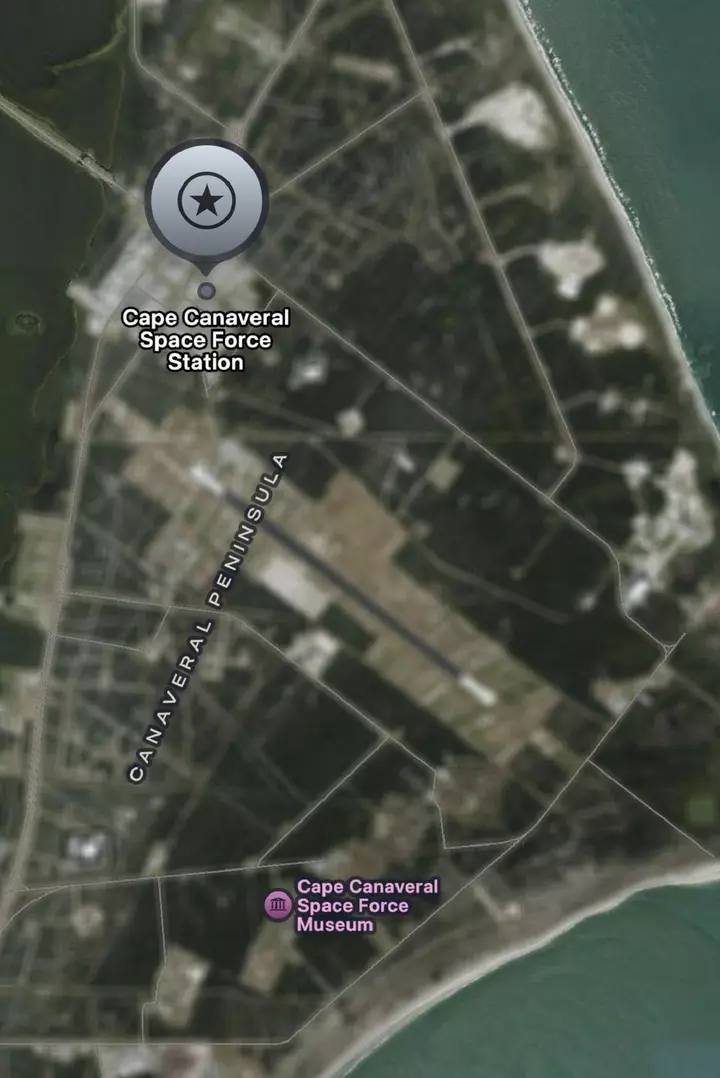
The changes, which appear to have begun in late October, were first reported by Space Explored on October 30. The affected locations include Cape Canaveral Space Force Station in Florida, Vandenberg Space Force Base in California and Groom Lake, better known as the highly secretive Area 51, in Nevada. The move has not been publicly explained by Apple, and it is unclear whether the company acted independently or in response to requests from U.S. government agencies.
Google Maps, meanwhile, continues to display clear satellite imagery of the same locations. Newsweek contacted Apple, Google, the Pentagon and NASA via email on Wednesday for comment. The locations initially identified as affected include Cape Canaveral Space Force Station and Patrick Space Force Base in Florida, key installations supporting U.S. military space operations; Vandenberg Space Force Base in California, a major military space launch facility; and Wallops Flight Facility in Virginia, where the airfield is blurred but its launch pads remain visible.
Other affected sites include Stennis Space Center in Mississippi, a NASA facility involved in rocket engine testing; Whiteman Air Force Base in Missouri, home to most of the U.S. Air Force's B-2 stealth bomber fleet; and Ellsworth Air Force Base in South Dakota, one of two U.S. bases hosting B-1B bombers. The list also includes Los Alamos National Laboratory in New Mexico, a major nuclear research facility.
Since initial reports of the changes, Dyess Air Force Base in Texas and Barksdale Air Force Base in Louisiana are also now appearing blurred, despite initially being identified as unaffected. The uneven coverage raises questions about how sites are being selected and whether the company is rolling out the changes in stages. While Apple Maps has obscured satellite imagery of the installations, Google Maps continues to show the same locations without comparable blurring.
This means users can still view satellite images of the affected facilities through Google's mapping service, despite the changes to Apple's platform. The difference also suggests the restrictions are not being applied universally across commercial mapping services. Apple has not publicly explained the decision or outlined the criteria used to select the locations.
The affected sites include facilities associated with military space operations, strategic bombers and sensitive government research, potentially pointing to security concerns. However, there is no confirmation that national security concerns prompted the changes. Notably, Kennedy Space Center and its historic launch pads, LC-39A and LC-39B, have not been affected, leaving the facilities used for NASA's Moon missions visible on Apple Maps.
Extract — continue reading at the source.