A potentially record-breaking El Niño is strengthening in the Pacific, raising concerns that warmer, wetter conditions could fuel an increase in hantavirus, West Nile virus and cyclospora infections across parts of the U.S. The climate pattern, which the National Oceanic and Atmospheric Administration (NOAA) says has a greater than 90 percent chance of forming in the fall and winter, can alter rainfall patterns, raise temperatures and reshape ecosystems across large parts of the United States. Those environmental changes can affect rodents, mosquitoes and even the movement of pathogens through food and water systems.
Experts caution that it remains far too early to know the exact impacts of the impending super El Niño or which parts of the country would experience the most pronounced effects. But previous El Niño patterns have provided clues about how climate anomalies can influence disease risk. If disease patterns are influenced by a strong El Niño, many of the effects may not emerge until after winter, during the spring and summer months.
Scientists say wetter and warmer conditions can help overwintering mosquitoes and rodent populations survive and expand, potentially increasing risks for illnesses like West Nile virus and hantavirus once temperatures rise. Cyclospora infections also tend to peak between late spring and early fall, meaning any climate-related impacts on foodborne disease risk could become more apparent months after the winter season. A Super El Niño is an unusually powerful El Niño weather pattern in which sea surface temperatures across the central and eastern equatorial Pacific Ocean rise to at least 2 degrees Celsius above average, significantly stronger than a typical El Niño.
While "Super El Niño" is not an official NOAA classification, it is commonly used by scientists and forecasters to describe rare, very strong weather disturbances. These events can dramatically alter weather patterns worldwide, increasing the risk of floods in some regions, droughts in others, warmer global temperatures, shifts in hurricane activity and crop disruptions. A potential Super El Niño developing in the Pacific could significantly reshape U.S. snowfall patterns this winter.
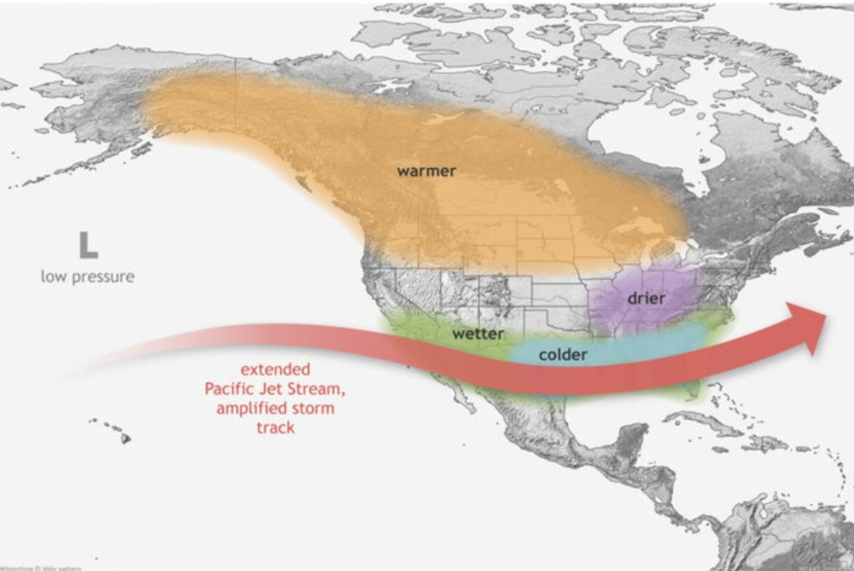
Forecasts suggest the best chances for above-average snowfall may occur across parts of the higher elevation Southwest and southern Rockies, including California's Sierra Nevada, Utah, Arizona, New Mexico and southern Colorado, where a stronger southern storm track could deliver more frequent winter storms. At the same time, some northern-tier regions, including parts of the Pacific Northwest, may see below-average snowfall as warmer temperatures limit opportunities for snow. Forecasters caution that El Niño tilts the odds toward certain patterns rather than guaranteeing outcomes, and warmer temperatures could cause some precipitation to fall as rain instead of snow, particularly at lower elevations.
A typical El Niño winter shifts the jet stream southward, often bringing wetter-than-normal conditions to California and across the southern tier of the United States while leaving parts of the northern U.S. warmer and less snowy than average. Strong El Niño events have historically favored increased precipitation along the West Coast and across portions of the South as storms track farther south than usual, the NOAA said. AccuWeather long-range forecaster Paul Pastelok previously told Newsweek that California is often among the regions most affected, with a stronger subtropical jet stream bringing persistent storms and heavier snowfall to the central Sierra Nevada.
Extract — continue reading at the source.