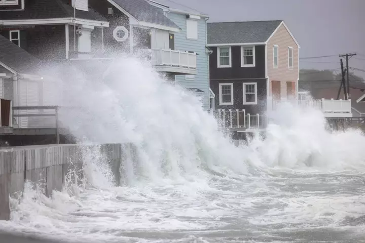
As a new nor'easter takes shape in the Atlantic, meteorologists are warning that the widespread impacts associated with such coastal storms could pose a greater threat to parts of the U.S. in the coming months than hurricanes have so far this year. The brewing storm comes just weeks after a similar nor'easter battered the East Coast in late September, bringing widespread impacts such as strong winds and lashing rains that lasted for days. So far, the Atlantic hurricane season has seen below-average activity this year, due largely to the strengthening El Niño in the Pacific Ocean.
While El Niño can disrupt the Atlantic hurricane season by increasing destructive wind shear that tears apart storms before they can form, it can contribute to more nor'easters during the winter months because of how it strengthens the southern jet stream, a National Weather Service (NWS) Weather Prediction Center meteorologist told Newsweek on Saturday. However, since those impacts are generally more often felt during the winter months when El Niño is at its peak, it's unclear how much of a role if any the climate pattern has played in the formation of the current nor'easter. "It's certainly possible the U.S. could experience more nor'easters than tropical storms or hurricanes impacting the coast before the Atlantic hurricane season ends on November 30, but it's too early to say," AccuWeather senior meteorologist Carl Erickson told Newsweek on Saturday.
"Nor'easters can produce significant coastal impacts even when their centers remain offshore." The Atlantic hurricane season runs from June 1 to November 30. Nine named storms have formed so far this year, including one hurricane, Hurricane Isaias, which made landfall near Destin, Florida, on October 9. An average Atlantic hurricane season has 14 named storms, with seven hurricanes and three major hurricanes, the National Hurricane Center (NHC) said.
The developing storm has prompted numerous warnings, with the NWS issuing storm and gale warnings. On Friday, a state of emergency was issued for Hatteras Island in North Carolina, and visitors were ordered to evacuate before the storm arrived, as it was expected to make parts of Highway 12 impassable, which could cut off roadway access to the island for days. "With this upcoming storm, our greatest concern is the prolonged duration of coastal impacts," Erickson said, adding that wind gusts could reach up to 60 mph along parts of the mid-Atlantic coast.
"The most significant impacts are expected from southeastern Virginia into the Outer Banks of North Carolina, where persistent onshore winds could cause significant coastal flooding, beach erosion and road closures. Since the storm is expected to linger offshore for several days, coastal communities could experience flooding over multiple high tide cycles, potentially compounding impacts in areas still recovering from the late-September nor'easter." The nor'easter could also take on some subtropical qualities, prompting a warning from the NHC as well. "A strong non-tropical low pressure area is expected to form during the next day or two off of the eastern coast of the U.S.
This low is likely to move slowly and erratically through the middle of next week, and some subtropical development is possible during this time," the NHC said. "Regardless of development, this system will cause high winds, coastal flooding, and dangerous surf along portions of the U.S. East Coast." The NWS explains that a nor'easter is a storm along the East Coast of North America where winds over coastal regions usually come from the northeast.
Extract — continue reading at the source.