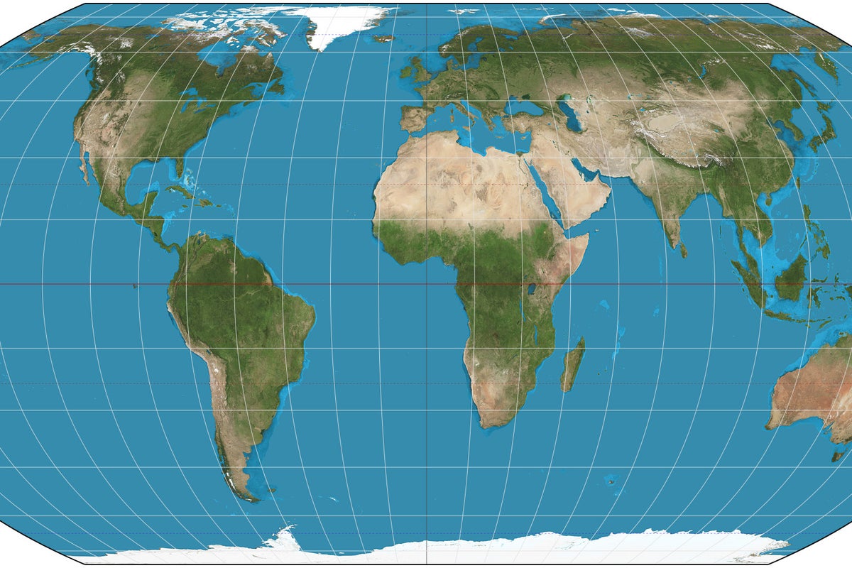
The article was originally published in August 2025 by The Conversation and is being republished by the Independent as the UN votes on adopting the Equal Earth map projection. The African Union has endorsed the #CorrectTheMap Campaign, a call for the United Nations and the wider global community to use a different kind of world map. The campaign currently has over 4,500 signatures.
The map most commonly used is called the Mercator projection. Map projections are how cartographers (map makers) “flatten” the three-dimensional Earth into a two-dimensional map. The Mercator projection was created over 450 years ago, designed for colonial exploration and maritime trade.
But, over the centuries, it has become an “all purpose” projection for many governments, educators and companies. That flat drawing inflates the size of countries closer to the North or South Pole. It exaggerates the area of North America and Eurasia while under-representing the size of much of South America and Africa.
As the largest continent in the global south, Africa is a victim of this cartographic inequity. The #CorrectTheMap campaign calls for a move to the Equal Earth map projection, developed in 2018 by an international team of cartographers. It addresses the distortions found in the Mercator projection.
Controversies over map projections are not new. Since the 1970s cartographers have discussed how certain projections distort how the Earth looks and how people imagine their place in that world. At the heart of the debates about maps are tensions about what sort of power maps have in the world.
A change in map projections, for the African Union, is about more than correcting a technical flaw. It’s also a chance to influence how current and future map users view, talk about and value Africa. The call is a demand for Africans to be represented on their own terms, rather than through cartographic traditions that have long diminished their scale and significance.
Extract — continue reading at the source.