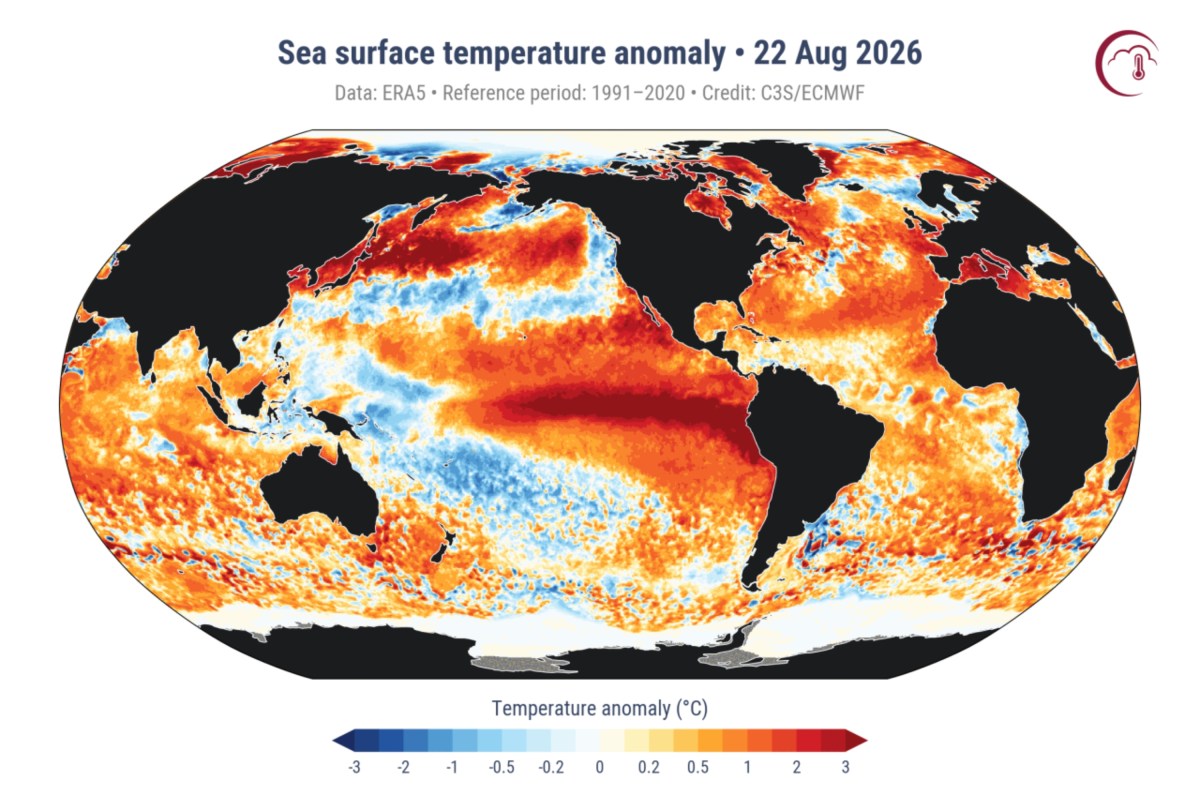
Record-high ocean temperatures combined with a strengthening El Niño could influence storms, rainfall and temperatures across the United States during the coming fall and winter, forecasters said. The average sea-surface temperature across the oceans reached 21.1 degrees Celsius, or about 70 degrees Fahrenheit, on Saturday, according to the European Union's Copernicus Climate Change Service. That figure narrowly exceeds the previous daily record of 21.09 C, which was recorded in March 2024.
"The timing of the record is particularly notable," Copernicus said. "Global ocean temperatures are typically highest in March and April, following the austral summer, yet this record has been reached in August." The record also arrives as El Niño continues to develop across the tropical Pacific, with the Climate Prediction Center forecasting a greater than 90 percent chance of a strong event during fall and winter. AccuWeather meteorologist Alex DaSilva told Newsweek that El Niño was a major contributor to the record as it covers a vast area of the Pacific, making records easier to topple when the climate pattern is active.
He added that unusually high temperatures across the Atlantic also helped push the global average to a new high. In an email sent to Newsweek on Tuesday, AccuWeather said the world's ocean reaching a new record represented another factor that could influence weather across North America into fall and winter. Paul Pastelok, the company's lead long-range forecaster, said the potential consequences for North America would depend not only on the ocean record but also on how the widespread warmth interacts with El Niño.
"What we're watching closely is how all of this ocean warmth interacts with a strengthening El Niño," Pastelok said in the email. "That combination can have important implications on intensity of storm track, temperatures and precipitation patterns across the continent in the months ahead." Warm ocean water increases evaporation, placing additional moisture into the atmosphere. At the same time, El Niño can alter the position and behavior of the jet stream, affecting where storms travel across North America.
During a typical El Niño, the Southern U.S. can experience a more active storm track extending from California and the Southwest through the Gulf Coast and Southeast. If storms tap into the additional atmospheric moisture supplied by unusually warm oceans, some could produce heavier rain or snow, according to AccuWeather. The outlet said California, the Southwest and other areas of the Southern U.S. could have more opportunities for precipitation during El Niño.
Southern and eastern states could also encounter longer periods of cloudy weather during the colder months. "Warm oceans don't guarantee more storms, but they can give storms more moisture to work with," Pastelok said. "The location and intensity of the jet stream and storm track will ultimately determine where that moisture goes and the rate that it falls." AccuWeather said El Niño forms when parts of the central and eastern tropical Pacific heat up beyond normal levels.
Extract — continue reading at the source.