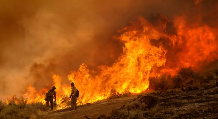
A strengthening El Niño could leave parts of the northern United States more susceptible to wildfires, even as the climate phenomenon lowers the threat across much of the South and Southwest. The latest outlook from the National Interagency Fire Center (NIFC) says El Niño has developed and is strengthening, with central Pacific sea surface temperature approaching 1.5 degrees Celsius above average, the threshold for a strong El Niño, while the Climate Prediction Center (CPC) says there is a greater than 90 percent chance it will become a "very strong" event during fall and winter 2026-27. Research published this year by the National Oceanic and Atmospheric Administration (NOAA) and the Cooperative Institute for Research in Environmental Sciences shows that an autumn El Niño could increase wildfire risk in some regions into next spring and summer, while reducing it in others—potentially creating a great dividing line between increased fire danger in parts of the northern U.S. and reduced danger further south.
El Niño is the warm phase of a natural climate cycle called the El Niño-Southern Oscillation, or ENSO. According to NOAA, during El Niño, Pacific trade winds—which are steady winds that blow from east to west across the Pacific Ocean—weaken and unusually warm surface water spreads eastward across the central and eastern tropical Pacific. The change affects where heat from the ocean enters the atmosphere and, in turn, alters the jet stream and weather patterns across the world.
The easiest way to think about it is that El Niño effectively rearranges the odds of certain weather conditions. In winter, it generally tilts the odds toward wetter and cooler conditions across much of the Southern U.S. and warmer, drier conditions across parts of the North. Those changes matter for wildfires because precipitation determines how wet vegetation becomes, while heat and dry air determine how rapidly it loses that moisture.
Park Williams, a hydroclimatologist and professor of geography at UCLA, told Newsweek that wildfire activity in the U.S. is generally lower during El Niño years, mainly because there tends to be fewer forest fires in the West. "The reasons for fewer forest fires are that forest fires in the Western U.S. are promoted by dry and hot conditions," Williams said. "El Niño generally causes winter and spring to be wet across the Southern U.S., including the Southwest U.S., and then summers are generally cooler and more humid than average across most of the Western U.S." NOAA research meteorologist Andrew Hoell said, "The El Niño-Southern Oscillation, through its La Niña and El Niño phases, offers a powerful tool for predicting the likelihood of extensive wildfire activity in several U.S. regions up to a year out," adding that such information is "crucial for wildfire managers as they prepare for wildfire activity." NOAA researchers found that after an autumn El Niño, large-scale atmospheric circulation can produce unusually high pressure over the northern tier of the country.
That increases the chance of large fires in the Eastern and Northern Rockies during the following spring. The areas potentially affected include parts of Montana, Idaho, North Dakota, South Dakota and Wyoming, which fall within the Northern Rockies wildfire region, according to NIFC's Northern Rockies geographic areas. However, the increased risk is regional rather than statewide, meaning an El Niño will not necessarily increase wildfire danger across the entirety of each state or be the direct cause of it.
Wildfire danger also depends on vegetation, fuel moisture, wind, drought, lightning and individual weather systems. Arizona and New Mexico, along with some parts of Texas and Oklahoma, could see a lower likelihood of extensive burning following an autumn El Niño. NOAA researchers found the likelihood of extensive burns was "consistently halved" in the Southwest wildfire region during the following spring and summer, due to higher precipitation and lower evaporative demand.
Extract — continue reading at the source.