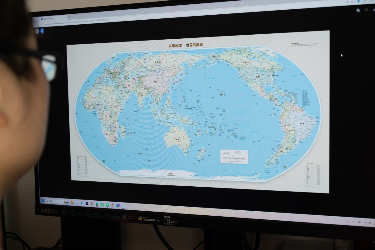
The United Nations this month overwhelmingly approved a resolution encouraging the use of a world map projection that more accurately depicts the size of continents, particularly Africa, whose landmass is distorted on many widely used maps. The United States was the lone country to vote against the measure, calling it a "radical ideological project." The resolution pushes for maps that better reflect the true size of continents, highlighting the Equal Earth projection. However, several other countries have spoken out against the map, citing border disputes, with six abstaining from the September 4 vote.
Dozens of African countries have long challenged the Mercator projection and came together to produce a resolution to “Correct the Map.” The Mercator projection, which was created in 1569 by Flemish cartographer Gerardus Mercator, remains widely used despite significantly distorting the size of countries and continents far from the equator, such as Greenland. The two areas look relatively similar on the Mercator projection, but in reality, Africa is about 14 times the size of Greenland. It was designed primarily for navigation.
Professor James Cheshire at University College London told the BBC that Mercator "wanted a straight line to be drawn on a map to look like a straight line in reality if you followed a compass bearing," which the map does well with some distortion. The new proposed map is the Equal Earth projection, created by cartographers Bojan Šavrič, Bernhard Jenny and Tom Patterson in 2018, that preserves the relative area of continents and countries more accurately. The passing of the resolution does not ban the Mercator projection but encourages the more “equitable representation of the world’s regions.” The African Union applauded the affirmative vote, writing on X that the “initiative marks a historic step toward accurate and equitable global cartographic representation.
Today’s resolution promotes equal-area maps like Equal Earth across classrooms, media, and international institutions ensuring the world map finally reflects Africa’s true scale, weight, and place in the world.” The U.S. is the sole member state to vote against the non-binding resolution, with Yaryna Ferencevych, deputy U.S. representative to the U.N. Economic and Social Council, saying: “This resolution mocks the work and purpose of this institution.” Ferencevych argued that the matter presented was part of a “much larger and more radical ideological project.” The United States, along with several other countries, including Russia, would appear relatively smaller in the new map. Ukraine, which abstained from voting, said it supports efforts to address historical distortions in world maps but objected to how the proposal depicts Ukrainian territory occupied by Russia, particularly Crimea.
Its representative warned that adopting the projection without sufficient safeguards could open a "Pandora's box" by creating ambiguity over disputed borders. Lithuania’s Foreign Ministry said the country abstained from voting for that reason. Russia has annexed several Ukrainian regions, claims rejected by Kyiv and much of the international community, making the depiction of borders and territory a particularly sensitive issue.
India, which also has its share of border disputes, voted in favor of the resolution, but said: “We also highlighted that the resolution does not constitute endorsement of any specific map, projection or depiction of national boundaries.” Indian spokesperson Shri Randhir Jaiswal said: “India’s sovereign territory, including the Union Territories of Jammu and Kashmir and Ladakh, must be depicted in accordance with India’s official map. Any inaccurate or misleading depiction is unacceptable. Our position on India’s sovereignty and territorial integrity is clear, consistent and non-negotiable.” Japan said it had requested a correction to an Equal Earth map displayed on its website, arguing that it depicts four disputed islands claimed by both Japan and Russia in the same color as Russian territory.
Extract — continue reading at the source.