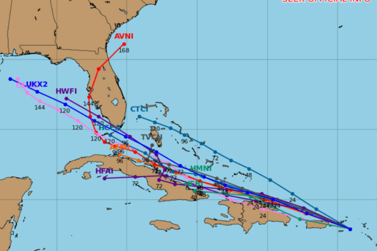
The remnants of former Tropical Storm Dolly are moving westward across the Caribbean, with several forecast models projecting the system or its leftover moisture could approach Florida later this week. While the National Hurricane Center (NHC) says redevelopment is unlikely over the next couple of days, forecasters are monitoring whether the remnants could reorganize as they move toward the southeastern Gulf and waters near the Sunshine State. Spaghetti models shared by meteorologists show a cluster of forecast tracks pointing toward the Florida Peninsula and eastern Gulf, although experts stress these projections represent the remnants of Dolly rather than a fully developed tropical cyclone.
Even weakened tropical systems can bring significant rainfall, flooding concerns and gusty winds. The NHC said Dolly's remnants are already producing showers and thunderstorms across portions of the northern Leeward Islands, the Virgin Islands and Puerto Rico, with locally heavy rain expected over the next several days. "Tropical Storm Dolly fell apart on Friday.
Now it might try to come back," digital meteorologist Ryan Hall wrote in a post on X Sunday. "The Hurricane Center says Dolly’s remnants could find more favorable conditions once they reach the Gulf around the middle of this week." For Florida residents, the primary concern remains the possibility that Dolly's tropical moisture could enhance rain chances later this week. While forecasters emphasize that no direct Florida impacts are currently guaranteed, conditions may become somewhat more favorable for redevelopment by the middle of the week as the system reaches the southeastern Gulf.
Meteorologists caution that spaghetti models are designed to show potential future tracks and uncertainty. A cluster of lines does not necessarily indicate a significant storm threat, particularly when the system in question has already lost its closed circulation. According to the NHC's latest Tropical Weather Outlook, the remnants of Dolly are moving westward to west-northwestward at about 25 miles per hour.
The agency said redevelopment is unlikely during the next 48 hours as the system tracks through an environment characterized by unfavorable conditions. The forecast calls for the tropical wave to continue bringing heavy rain to the Leeward Islands, the Virgin Islands and Puerto Rico before moving farther west across the Caribbean. The NHC currently assigns the system a near-zero chance of redevelopment over the next two days and a 20 percent chance over the next seven days.
"I know the lines can initially appear ominous, but we need to put things into perspective first," meteorologist Matt Devitt wrote in a Sunday X post. "These are tracks for the leftovers of Dolly, which includes extra tropical moisture and additional rain chances for the area it heads toward. Florida still needs the rain!
Extract — continue reading at the source.