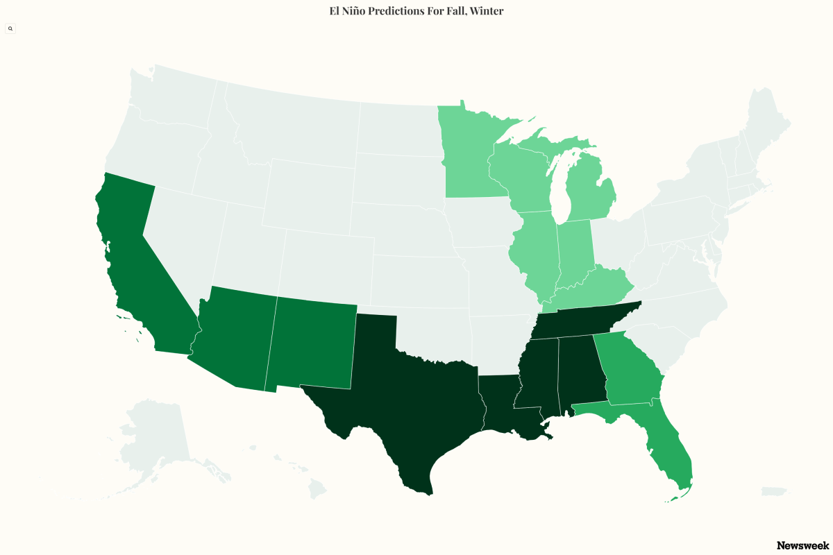
A strengthening super El Niño is expected to become the dominant driver of U.S. weather during the coming months, with forecasters warning that one of the strongest events in decades could begin reshaping rainfall, storm tracks and snowfall patterns as fall progresses into winter. El Niño occurs when ocean waters across the equatorial Pacific become warmer than average, altering atmospheric circulation and influencing weather around the globe. Confidence that the climate pattern will meet the threshold for a super El Niño is near 100 percent, AccuWeather said on Thursday.
While some early signals may emerge by October, meteorologists say the phenomenon's most noticeable impacts are likely to intensify from late fall into winter, bringing wetter conditions to parts of the South and California while leaving other regions warmer or drier than average. A super El Niño develops when warming in the tropical Pacific reaches unusually high levels, strengthening the atmospheric ripple effects that influence weather worldwide. While the National Oceanic and Atmospheric Administration (NOAA) does not officially use the term "super El Niño," instead classifying events by strength categories such as "strong" and "very strong," the phrase is widely used by other forecasting agencies, meteorologists and researchers to describe exceptionally intense El Niño episodes.
NOAA has said the developing event is already showing signs that it could reach the agency's "very strong" category by winter. For the U.S., the classic super El Niño pattern often brings additional storms to California and the southern tier of states. The northern United States frequently experiences milder conditions, while parts of the Pacific Northwest may trend drier than average.
However, meteorologists caution that El Niño is only one factor influencing winter weather, and individual storms can still produce outcomes that differ from the seasonal pattern. AccuWeather long-range forecaster Paul Pastelok told Newsweek that a detailed forecast for the developing El Niño has not yet been finalized, and its eventual impacts could still differ from current expectations. Some weather-related impacts, which Pastelok called “previews” of the El Niño impacts to come, have already been felt in the U.S., such as the drought and fires across the Pacific Northwest and the Rocky Mountains, which could be influenced by warming water temperatures in the Pacific Ocean associated with the strengthening El Niño.
The dry spells felt across the center of the U.S. in July, such as in Iowa and Nebraska, also could have been influenced by El Niño, although Pastelok said he doesn’t think these are “direct effects,” as those that are more likely in the cooler season. The strongest El Niño impacts are felt in North America in the cooler seasons because that is when the northern and southern jet streams interact with each other, Pastelok said. Southwest and the region from Texas to the Tennessee Valley could begin to see changes in weather in late October to November, Pastelok said.
The number of “upper lows,” or areas of low pressure in the middle or upper atmosphere, coming into the area will increase the chances of rain and flooding. In response to the change, drier conditions will be felt across the Great Lakes and Upper Midwest by mid-fall or later in the fall. Severe weather will start in Florida and southern Georgia in November, with Jacksonville, Tampa and Orlando at risk of tornadoes beginning in November, Pastelok said.
Extract — continue reading at the source.