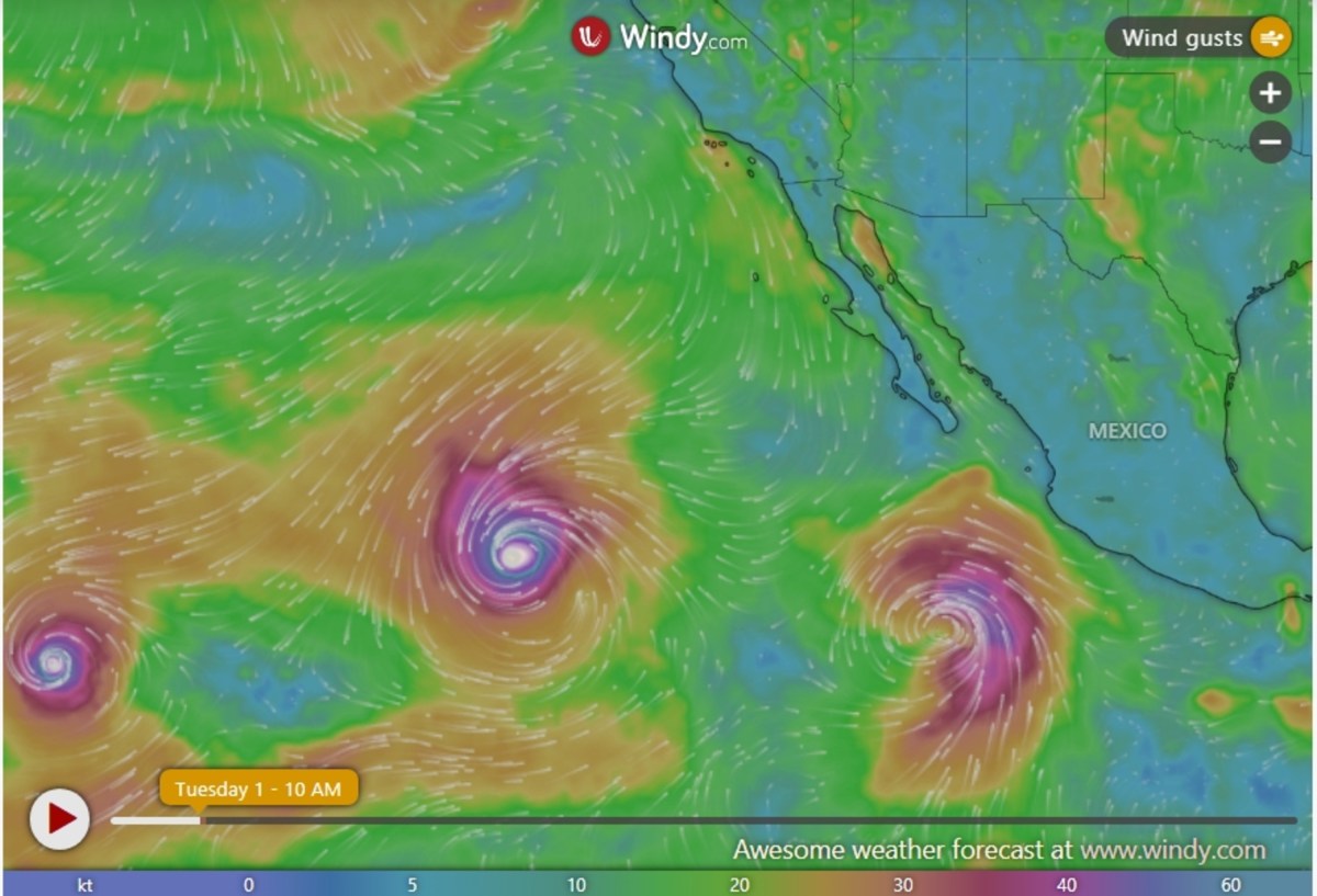
Hurricane Karina continues to churn across the eastern Pacific on Tuesday as a powerful Category 4 storm, with forecasters tracking its west-northwestward path over open ocean. The latest Hurricane Karina update shows the storm moving west-northwest at about 10 miles per hour, well away from Mexico and other populated areas. Forecasts indicate Karina will remain over open waters while gradually weakening later this week, though it is expected to maintain hurricane strength for several days as it continues deeper into the Pacific.
Forecasters have not issued any coastal watches or warnings, and the storm is not currently forecast to make landfall. While Karina poses no immediate threat to land, the storm has generated large swells that can produce dangerous surf and rip currents. Earlier advisories warned that those swells could affect portions of southwestern Mexico and the Baja California Peninsula, creating hazardous beach conditions even hundreds of miles from the hurricane's center.
Karina strengthened into a hurricane on Sunday after forming as a tropical storm last Thursday. Animated satellite imagery from windy.com shows Hurricane Karina about 1,210 miles west-southwest of the southwestern tip of Baja California. Other tropical storms, including Tropical Storm Lowell to the left and Tropical Storm Marie to the right, are also visible in the live animated footage.
Hurricane Karina is not expected to make direct landfall; it is currently churning in the central Pacific Ocean. However, strong swells and rip currents can be felt hundreds of miles away from the storm, and the NHC warned of a moderate risk of rip currents in Southern California. "Swells generated by Karina will affect portions of the coast of southwest Mexico and the Baja California Peninsula for the next couple of days and will likely spread northward to southern California through midweek," the public advisory said.
"These swells are likely to cause life-threatening surf and rip current conditions." Animated tracker maps from windy.com show strong waves around the storm but calmer waters closer to land. Spaghetti models, which combine forecasts from multiple weather prediction models into a single graphic, show Hurricane Karina continuing on a generally west-northwest track across the open eastern Pacific with relatively little disagreement among forecasters. The models also indicate that Karina is near its peak intensity and should steadily weaken later this week as environmental conditions become less favorable.
As of Tuesday morning, Karina was a powerful Category 4 hurricane with sustained winds of 140 mph. As of Tuesday morning, Tropical Storm Edouard was located in the northwestern Gulf of Mexico just off the Texas-Louisiana coast. The NHC placed the storm's center about 30 miles south of Cameron, Louisiana, and 50 miles southeast of Port Arthur, Texas.
Extract — continue reading at the source.