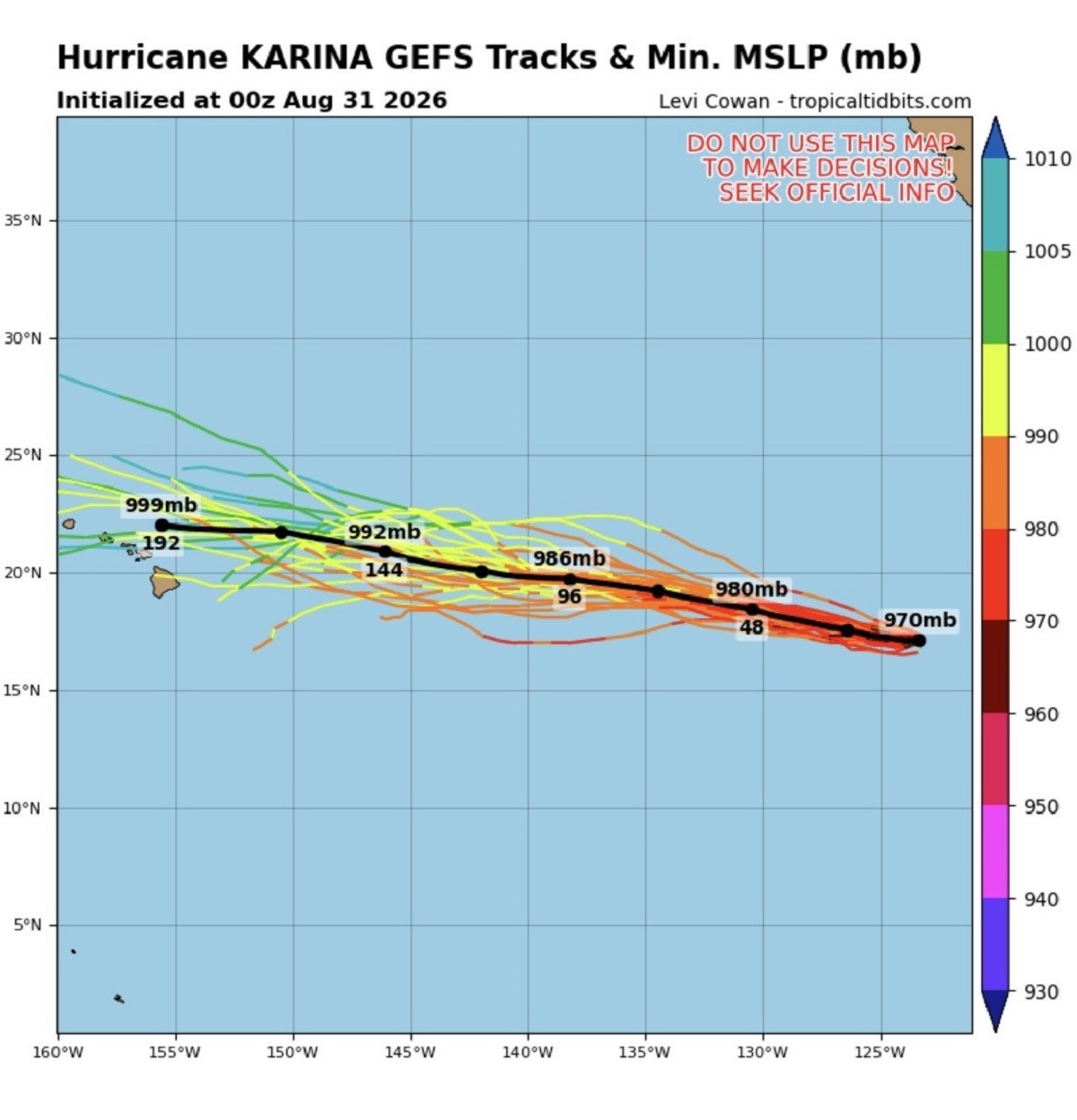
Hurricane Karina has strengthened into a powerful Category 4 storm over the eastern Pacific, and swells generated by the storm are expected to spread north toward Southern California, bringing potentially life-threatening surf and rip-current conditions. An advisory from NOAA's National Hurricane Center (NHC) states: "Swells generated by Karina will affect portions of the coast of southwest Mexico and the Baja California Peninsula for the next couple of days and will likely spread northward to southern California on Monday through midweek. These swells are likely to cause life-threatening surf and rip current conditions." Hurricane Karina itself is not forecast to track toward California.
The storm is moving westward, farther out into the Pacific. The California threat comes from the swells generated by the hurricane, which can travel hundreds of miles ahead of and away from the storm. Karina was about 1,020 miles (1,640 kilometers) west-southwest of the southern tip of Baja California late Sunday, according to the NHC.
The hurricane had maximum sustained winds of 145 mph and was moving west at 9 mph. There are no coastal watches or warnings in effect. Newsweek contacted NOAA via email on Monday for comment.
The latest spaghetti-model guidance on Tropical Tidbits, a meteorological website and data visualization platform specializing in tropical cyclone tracking, weather analysis, and forecasting, shows Karina continuing generally westward over the open Pacific, with forecast tracks keeping the center of the hurricane well offshore of Mexico and California. The maps use various acronyms. GEFS stands for Global Ensemble Forecast System, a weather model that runs many slightly different forecasts to show a range of possible storm tracks.
Tracks is the predicted paths of the storm's center from those different forecasts. MSLP means minimum mean sea level pressure. This is the lowest atmospheric pressure the storm is expected to reach.
Mb denotes millibars, the unit used to measure atmospheric pressure, whereas hPa means hectopascals, the standard unit meteorologists use for atmospheric pressure. A lower MSLP generally means a stronger storm. The NHC's latest forecast has Karina continuing west Monday before turning west-northwest Tuesday.
Extract — continue reading at the source.