A tropical rainstorm churning across the northern Gulf Coast is expected to bring rounds of heavy rain, localized flash flooding and travel disruptions to parts of Texas and Louisiana this week, with forecasters warning that some communities could receive several inches of rainfall in a short period of time. While the system is not expected to become a major wind event, forecasters say rain will be the primary hazard as it approaches the coast. The National Hurricane Center (NHC) on Monday began issuing advisories on Potential Tropical Cyclone Five, a disturbance in the northwestern Gulf that was producing sustained winds of 35 miles per hour.
Tropical storm warnings were issued for portions of the upper Texas and southwestern Louisiana coastline as the system moved west-northwestward at about 5 mph. Forecasters say the disturbance has a window to strengthen before coming ashore. AccuWeather reported the rainstorm could briefly organize enough to become either a tropical depression or a tropical storm before making landfall Tuesday, although significant intensification is not expected.
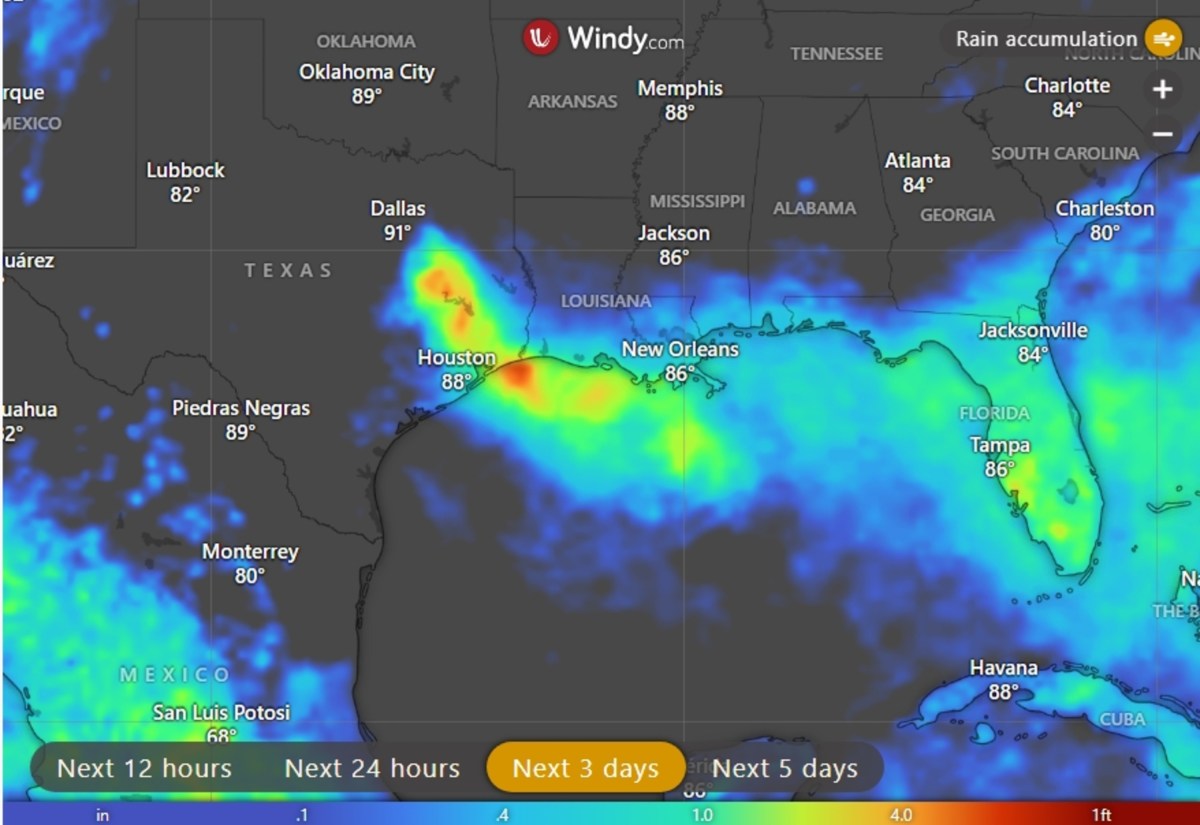
If it reaches tropical-storm strength, the next name on the Atlantic list would be Edouard. The heaviest rainfall is forecast to first affect coastal Louisiana before spreading westward into southeastern Texas, including the Houston metropolitan area. Animated weather footage from windy.com shows heavy rain over the next few days across coastal Texas and Louisiana.
Some areas will see as much 9 inches of rain. "PTC Five is expected to produce rainfall totals of 3 to 6 inches with maximum totals of 9 inches for parts of the Upper Texas Coast inland through east-central Texas, with 2 to 3 inches for Southwest Louisiana," the NHC said. "This rainfall could produce flash flooding, especially in low-lying and urban areas." According to AccuWeather, widespread rainfall totals of 1 to 2 inches are expected along the Louisiana coast and into eastern Texas through midweek, with a corridor of 2 to 4 inches possible around Houston and southeastern Texas.
Some locations could see considerably higher totals where thunderstorms repeatedly move over the same areas. AccuWeather's Local StormMax forecast indicates that isolated locations could receive as much as 12 inches of rain through Wednesday. Forecasters expect showers and thunderstorms to increase across Louisiana on Monday before spreading into coastal Texas Monday night and Tuesday.
Houston and surrounding communities are expected to experience the most persistent rainfall from late Monday into Tuesday, raising the risk of flooded roadways and travel delays during peak commuting hours. Satellite imagery available through windy.com shows the storm approaching the coast late Monday morning. Even in places that do not receive the highest rainfall totals, intense downpours could quickly overwhelm drainage systems and produce standing water in low-lying areas.
Extract — continue reading at the source.