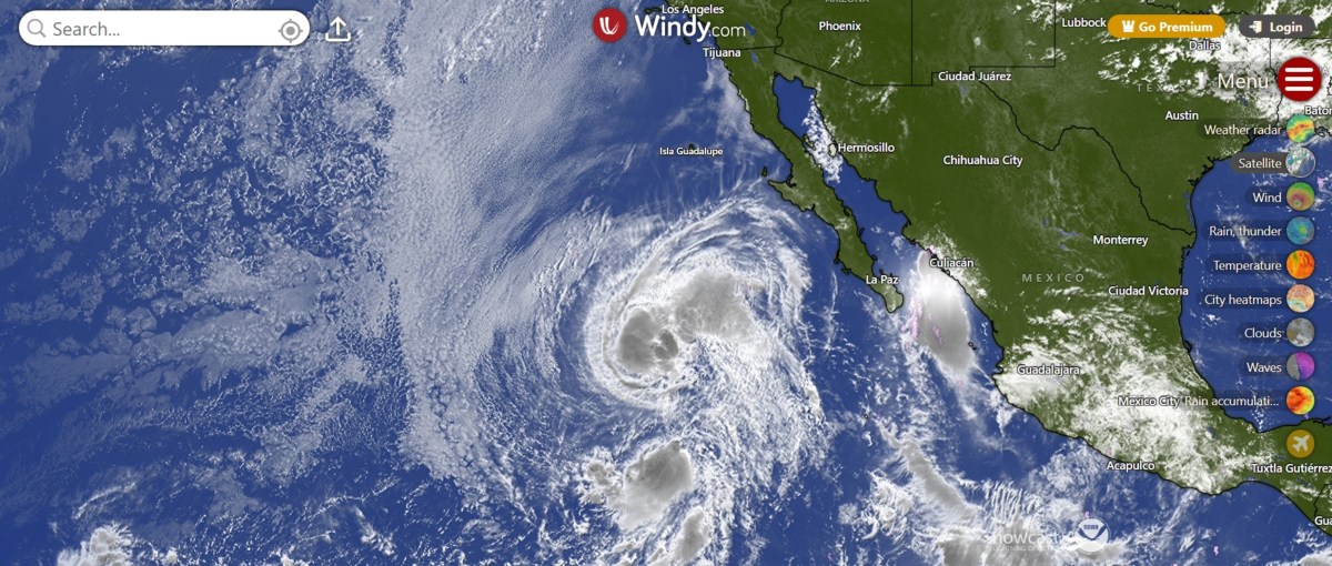
Two tropical storms swirling across the eastern Pacific Ocean are on a collision course that forecasters say will end with one storm effectively swallowing the other. According to the National Hurricane Center (NHC), Tropical Storm Julio formed Tuesday morning west-southwest of Mexico's Baja California Peninsula but is expected to have a short lifespan. Forecasters say the smaller storm will be absorbed by the larger and stronger Tropical Storm Iselle later Tuesday as the two systems draw closer together.
The unusual interaction is creating a striking scene on satellite imagery and forecast maps, with the storms appearing to spiral closer to each other over the open Pacific before eventually merging into a single tropical cyclone. Newsweek reached out to the NHC by email for comment on Tuesday. As of Tuesday morning, Julio was about 675 miles west-southwest of the southern tip of Baja California and carried maximum sustained winds of 50 mph.
The storm was moving north-northeast at 22 mph, much faster than Iselle's 10 mph. The NHC said little additional strengthening is expected before Julio becomes absorbed by Iselle later in the day. Iselle was centered roughly 730 miles west of Baja California with maximum sustained winds near 70 mph, making it the stronger of the two storms.
The system has remained just below hurricane strength and is forecast to gradually weaken over the coming days. Forecast tracking maps show Julio moving directly toward Iselle. Rather than continuing as separate storms, meteorologists expect the two circulations to merge, leaving Iselle as the dominant surviving system.
No coastal watches or warnings are in effect because both storms remain far from land and are expected to stay over open water. However, the NHC warned that Iselle could generate dangerous waves. "Swells generated by Iselle are affecting the west coast of the Baja California Peninsula, and will continue for a couple more days," the NHC said in a public advisory about the storm.
"These swells are likely to cause life-threatening surf and rip current conditions." Animated weather footage from windy.com shows Tropical Storm Julio edging closer to Tropical Storm Iselle in the hours remaining before the expected absorption. Animated wind speed maps also show Julio quickly catching up to Iselle. Dangerous waves will impact Baja California from Iselle, but a direct landfall is not expected.
Extract — continue reading at the source.