Polo’s rapid intensification comes after forecasters predicted a more active Pacific hurricane season this year, thanks in part to the effects of El Niño. This naturally recurring climate pattern, which is associated with warmer Pacific waters and this year has already broken records, is known to influence weather conditions worldwide. It can also lead to increased Pacific hurricane activity.
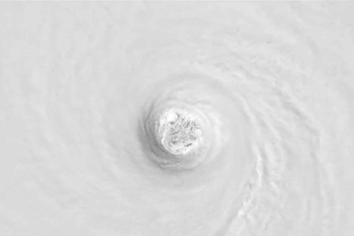
"El Niño conditions are associated with more tropical storm and hurricane activity during the eastern and central Pacific hurricane seasons," Matthew Rosencrans, National Oceanic and Atmospheric Administration’s (NOAA) lead for its seasonal hurricane outlook, told Newsweek previously. As of Wednesday morning, Polo was classed as a formidable Category 4 hurricane—the second-strongest rating on the Saffir-Simpson Hurricane Wind Scale. The Cooperative Institute for Research in the Atmosphere (CIRA) shared satellite imagery which it said offered an "extraordinary high-resolution view" of the system at Category 5 strength—the most powerful rating on the Saffir-Simpson scale.
Captured aboard the NOAA-20 satellite, the images show the storm in both visible and infrared light, including a closer look at the hurricane’s swirling eye. "Hurricane Polo is currently a very strong Category 4 hurricane this morning as it is slowly shifting back northwest," AccuWeather meteorologist Nick Arman told Newsweek on Wednesday. "Polo reached a peak sustained intensity Tuesday afternoon of 180 mph, with a pressure of 892 mb.
"These two measurements make it one of the strongest recorded hurricanes in the Pacific basin," Arman said, with its pressure of 892 mb being the second-lowest on record in the basin, surpassed only by Hurricane Patricia, which reached 872 mb in 2015. The storm "likely received a relatively direct boost from the strongest El Niño on record," Washington Post weather writer and meteorologist Ben Noll wrote in a post on X, Tuesday. Arman explained that factors behind the storm’s swift strengthening included "very warm" waters southwest of Mexico, not only on the surface but also extending deep into the ocean, "providing plentiful fuel for Polo to rapidly intensify." Moisture-laden air surrounding the storm, as well as a lack of hostile winds capable of disrupting development, also contributed to the system intensifying "exceptionally quickly," according to Arman.
CST update on Wednesday, the National Hurricane Center (NHC) said Polo was positioned around 165 miles south of Zihuatanejo, Mexico, and was drifting northward. The agency reported that the system was expected to track near Mexico’s southwestern coast during the next day or so, though it is forecast to remain offshore as of reporting. The NHC said Polo would likely remain "a very powerful major hurricane" during the coming days.
The hurricane is expected to deliver between three and six inches of rain, with isolated totals up to eight inches, across coastal portions of the Mexican states of Guerrero and Michoacán through Thursday, which the NHC warned could cause life-threatening flooding and mudslides. Coastal Oaxaca, Colima and Jalisco can expect two to four inches of rain, according to the agency. The Saffir-Simpson Hurricane Wind Scale categorizes hurricanes from Category 1 to Category 5 based on their maximum sustained wind speed, according to NOAA.
Extract — continue reading at the source.