A tropical depression expected to become Tropical Storm Moke later Friday is forecast to bring another round of heavy rain, flooding concerns and dangerous surf to Hawaii this weekend, just days after Hurricane Lala drenched parts of the island chain. As of Friday morning, the National Hurricane Center (NHC) was tracking Tropical Depression Two-C southeast of Hawaii with maximum sustained winds of 35 mph. Forecasters said the system is expected to strengthen into a tropical storm and pass south of the Big Island this weekend before moving south of the smaller Hawaiian Islands by Sunday night.
No tropical storm watches or warnings had been issued as of Friday morning, though residents were urged to closely monitor forecasts. Forecast maps show Moke following a path broadly similar to that taken by Lala, which recently brought flooding rains to portions of Hawaii. However, current forecasts keep Moke farther south of the islands, reducing the likelihood of a direct landfall while still exposing the state to significant rainfall and coastal hazards.
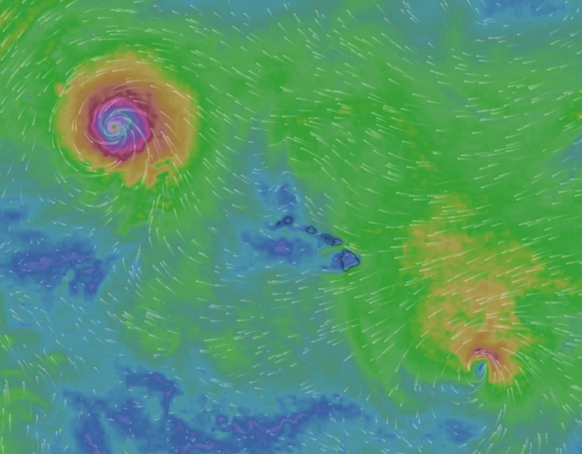
The unusually active weather pattern in the Central Pacific is also drawing attention because Moke is developing while Hurricane Lala remains active farther northwest of Hawaii. Animated weather footage from windy.com shows the two tropical systems occupying different areas of the basin simultaneously, underscoring an exceptionally busy stretch for the region. The greatest concern is expected to be flooding on the Big Island, where soils remain saturated from recent storms.The National Weather Service (NWS) in Honolulu has issued a flood watch for much of the Big Island from late Saturday night through Monday afternoon.
Forecasters warned that flash flooding is possible as bands of tropical moisture move across windward and southeastern portions of the island. "Tropical Depression Two-C is forecast to bring periods of heavy rain to the Big Island from late Saturday night through Monday afternoon," the flood watch said. "Rainfall totals of 5 to 10 inches, locally up to 15 inches, are possible on windward and southeast Big Island.
It will not take a significant amount of rain to cause flash flooding due to saturated grounds from recent heavy rains." The Big Island will be hit hardest, with the NHC forecasting up to 12 inches of rain. Streams could overflow, roads may become impassable and urban areas could experience rapid runoff and property damage. "This rainfall may produce life-threatening flooding and mudslides for the windward and southeast Big Island, especially in steep terrain and over areas that were affected recently by Lala," the NHC said in its public advisory.
Meanwhile, animated weather footage from windy.com also showed heavy, accumulating rain hitting the Big Island over the next five days. The heaviest rain is expected to arrive on the Big Island late Saturday night and continue through Sunday before spreading westward across the rest of the state. Maui could receive up to 4 inches of rain, while other islands may see 1 to 2 inches.
Extract — continue reading at the source.